Mission
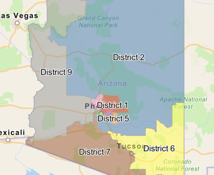
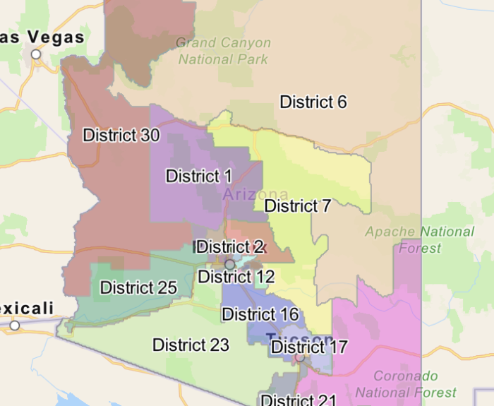
The Independent Redistricting Commission's mission is to redraw Arizona’s congressional and legislative districts to reflect the results of the most recent census. The concept of one-person, one-vote dictates that districts should be roughly equal in population. Other factors to be considered are the federal Voting Rights Act, district shape, geographical features, respect for communities of interest and potential competitiveness. The state Constitution requires the commissioners – two Republicans, two Democrats and an independent chairperson – to start from scratch rather than redraw existing districts.
A new Arizona Independent Redistricting Commission was appointed in January 2021 to adopt new congressional and legislative districts for Arizona. This comprehensive website is being used to inform the public about its work.
Meeting Notice
The Commission is providing this notice regarding the physical and electronic locations where all public notices regarding public meetings are posted. The Commission posts all public notices and agendas on the Arizona Public Meetings website under Public Meetings and at the Arizona Independent Redistricting Commission, 1110 W. Washington St., Phoenix, AZ 85007.
Upcoming Public Meetings
There are no future Commission meetings currently scheduled. Please check back again later.